





The Day the Roof Fell: Why the 2026 Himalayan Collapse was a Warning the World Ignored 1. Introduction: The Fragile Roof of the World The Hindu Kush-Himalaya (HKH) region is the planet’s “Third Pole,” a vertical wilderness holding the largest reserve of frozen water outside the Arctic and Antarctic. For generations, this massive ice shelf […]
The Day the Roof Fell: Why the 2026 Himalayan Collapse was a Warning the World Ignored
1. Introduction: The Fragile Roof of the World
The Hindu Kush-Himalaya (HKH) region is the planet’s “Third Pole,” a vertical wilderness holding the largest reserve of frozen water outside the Arctic and Antarctic. For generations, this massive ice shelf was considered a silent, stoic guardian of the continent. That perception shattered at 08:37 NPT on August 26, 2026. It began not with a rumble, but with an M s 5.2 seismic signature felt by sensors across the globe. This was the moment the “Roof of the World” literally began to fall. For the billions living downstream, the 2026 disaster was a terrifying proof of concept: the glaciers are no longer just melting; they are structurally failing.
2. The “Time Bomb” Inventory: 200 High-Risk Lakes
The strategic risk profile of the Himalayas has shifted from gradual retreat to sudden, violent reorganization. Data from the International Centre for Integrated Mountain Development (ICIMOD) and the UNDP identify a terrifying inventory of instability. While 47 glacial lakes were flagged in the specific basins connected to Nepal, the estimate for the entire HKH region now exceeds 200 “high-risk” lakes—aquatic time bombs waiting for a trigger.
These are not static features. Thulagi Lake, for instance, has expanded its surface area by 31% over three decades; a breach there could unleash a surge of 5,400 tons of water per second. With collapse risks projected to triple by 2101, experts are sounding the alarm on a fundamental shift in mountain geomorphology.
“The period of glacial retreat due to warming will be a ‘dangerous transition’ globally,” warns ICIMOD. We are moving beyond a climate crisis into a period of topographic chaos where the mountains themselves are being physically reshaped.
3. When Glaciers “Snap”: The Langtang Lirung Collapse
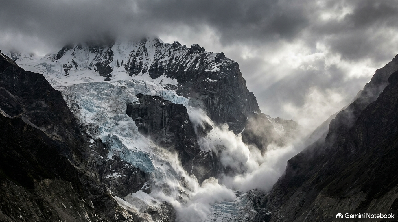
The 2026 disaster was counter-intuitive, a “glacier collapse” rather than a standard rain-induced flood. The failure occurred on the north face of Langtang Lirung, originating from an unnamed glacier at an altitude of 5,200–5,400 meters. This wasn’t a slow melt; it was a structural failure of what scientists call “cryospheric glue.” Permafrost, which has held these rock and ice faces together for millennia, has been weakened by warming trends until the mountain simply snapped.
The volume of the collapse was staggering: between 100 million and 200 million m³ of ice and rock broke free.
“It looks like a glacier in the area basically snapped off in a clean break, allowing it to fall just over a vertical kilometer to the valley bottom,” explains geologist Daniel Shugar of the University of Calgary.
The physics of the event were lethal. The sheer velocity and friction generated by a 1.2-kilometer vertical drop caused the ice to melt instantly upon impact, displacing the river below and transforming the debris into a high-speed liquid wall.
4. The 180 km/h Tsunami: Speed Beyond Preparation
This was a “glacial tsunami”—a cascading mixture of water, soil, and ancient rock moving with the force of a tectonic hammer. The debris flow reached speeds of 50 m/s (180 km/h) and surged 80 kilometers downstream, with floodwaters reaching settlements 80 meters above the standard river level.
The 2026 toll serves as a grim ledger of the region’s vulnerability:
- Casualties: In Nepal, 788 confirmed deaths and over 2,500 missing. Crucially, the disaster was a cross-border catastrophe, claiming 16 lives in Tibet with another 546 missing. The power of the surge was such that victims’ bodies were recovered in India, 240 kilometers away from the impact site.
- Infrastructure: Nepal suffered $1.3 billion in damages, including the total destruction of the strategic Gyirong Port. The torrent wiped out 41 bridges and 42 kilometers of road, much of which was still being rebuilt following a precursor flood in July 2025.
- Energy: The collapse crippled the regional grid, knocking 431 megawatts of electricity offline as six major hydropower facilities were buried or breached.
5. The Monitoring “Blind Spot”
The 2026 event exposed a lethal strategic failure in our early warning systems. Current safety infrastructure, optimized for the gradual buildup of monsoon floods, was useless against an instantaneous glacial “snap.” The Stimson Center had previously identified the region as a monitoring “blind spot,” a warning that went unheeded until it was too late.
The failure was both systemic and physical. As the wave hit, upstream monitoring stations were physically swept away before they could transmit data to downstream communities. We are trying to monitor 25,000 scattered lakes at extreme altitudes with 20th-century tools.
As Professor Cho Won-cheol emphasizes, “Satellite tracking of glacial lake formation… along with real-time sharing of monitoring data and alerts between countries, is essential.” Without cross-border data transparency, downstream nations are flying blind.
6. The Water Paradox: From Deluge to Drought
The 2026 tsunami is the violent opening act of a two-stage crisis. Currently, we are in the “deluge” phase, where melting ice creates excess water and instability. However, the Himalayas act as “natural reservoirs” for 1.65 billion people. As these glaciers disappear, we approach “peak water”—projected for 2050—followed by a permanent, irreversible decline in flow.
The very rivers that currently threaten to drown the region—the Indus, Ganges, and Brahmaputra—will eventually run dry during the off-monsoon seasons. The “time bombs” of today’s floods are the precursors to tomorrow’s terminal water shortages, threatening the food and energy security of nearly a quarter of the human population.
7. Conclusion: Beyond the Breaking Point
The August 2026 disaster was not an anomaly; it was a symptom of a “dangerous transition” where the high-altitude environment is moving toward a new, more volatile equilibrium. The Himalayas are reorganizing, shedding their ice and rock in a violent attempt to adapt to a rapidly warming atmosphere.
The strategic question is no longer if another collapse will happen, but whether we can adapt our infrastructure and international cooperation faster than the topography is failing. Our current systems were built for a world of stable ice; that world is gone. As the mountains fall, will we continue to ignore the signals until the next “snap”?
Stay up to date with our latest news and products! Subscribe to our newsletter to receive the latest articles, important updates, and exciting announcements directly in your inbox.